


California Wildfires Information: Updated Fire Maps
Disaster Alert
January 10, 2025
Below are updated maps showing fire damaged areas of Los Angeles County. Graphics courtesy of Cal Fire.
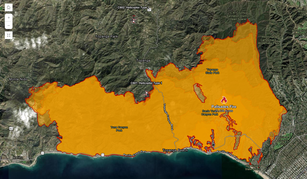
Palisades Fire:
20,438 Acres
8% Containment

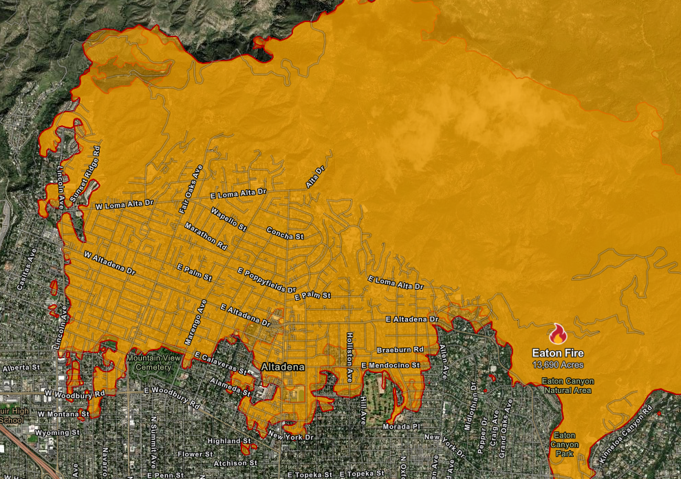
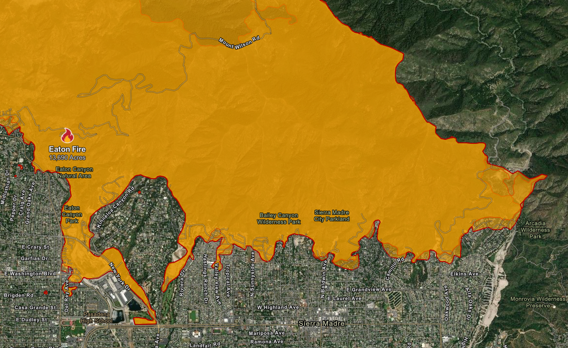
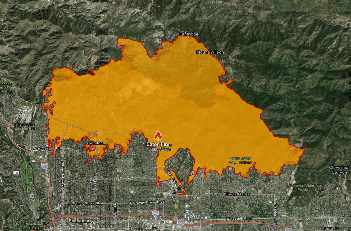
Eaton Fire:
13,690 Acres
3% Containment
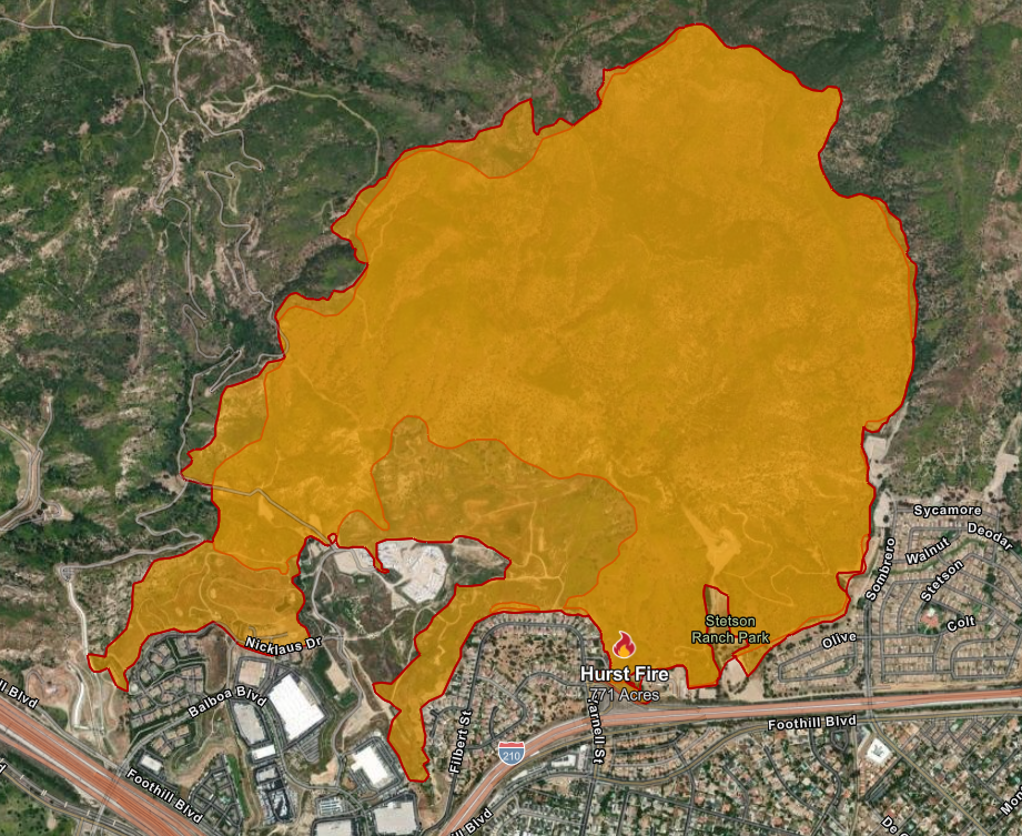
Hurst Fire:
771 Acres
37% Containment
Click here for a list of zip codes associated with affected areas, designated by fire.
We will continue to update as additional information is acquired.
To order an inspection, please log-in to your SafeView Access account.
To read the full articles, please click the source links above.